
UMD Campus Web Map
Ghost tours, iconic landmarks and the campus arboretum are just a few of the new features included in the new interactive UMD Campus Web Map, which debuted Oct. 31.
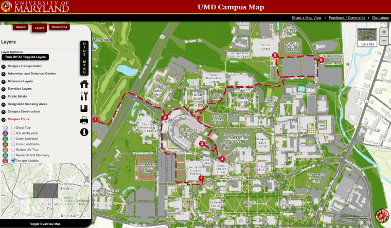
The map is a first at this university, boosting interactivity with the help of UMD Campus Enterprise Geographic Information System, a collection of computer hardware aimed to improve the way geographic information is communicated. It’s more interactive than TerpNav and allows users to customize their view of the campus and create their own routes and highlighted areas. The map also incorporates a distance-measuring element, a directions feature, campus webcams and construction locations.
Brenda Testa, facility planning department director within Facilities Management and GIS committee chairwoman, said the development of an all-inclusive map was overdue. A collaboration among Facilities Management, Information Technology and the geographical sciences department, the project was financed using existing funds.
“The initiative has been years of in the making. Many of us have recognized that we don’t have the best mapping for the university,” Testa said. “If you looked anywhere, benchmark other major institutions like the University of Maryland, our mapping was not very sophisticated. We were not in any way comparable to what those other institutions had.”
Ashok Agrawala, a computer science professor and GIS committee member, acknowledged previous mapping projects like TerpNav, but said they lacked cohesion.
“The campus has needs for a map for so many different sources: visitors, students, facilities and utilities people, all kinds of things,” Agrawala said. “Having a common map that everyone could rely [on] and resolve all the conflicts is a tremendous value to the campus and community.”
Besides incorporating elements from previous projects, the GIS map introduces features such as an overlay option that maps out the campus’ arboretum. It identifies thousands of trees on the campus, from the Japanese maples outside of McKeldin Library to the red oak by Ritchie Coliseum.
“What’s different about this new interactive mapping is that this is an institutionally recognized mapping for the campus and we are putting in place a lot of processes for updating, ownership of data, accuracy of our mapping,” Testa said. “There will always be a need for the static maps, but it was a very happy day when we released it.”
However, the map is still new, and junior community health major Diana Kim said she hadn’t seen much publicity for it. Kim, who works at the Stamp Student Union information desk, said she’d never heard of the map nor been asked about it.
“I’ve used [TerpNav] a few times whenever anyone needs direction,” she said. “I haven’t used [the new map] yet.”
Taylor Keen, the campus GIS coordinator, noted that the map has an added bonus — its improved accuracy will provide resources for public safety and give police better directions when they respond to a call.
“The police do use our base mapping to support their dispatch system,” Keen said. “We are trying to make sure that all of the campus stakeholders that need access to this data have it. The most accurate and most up-to-date information is what we’re shooting for.”
Preeti Bhargava, a computer science doctoral candidate, hopes the collaboration among Facilities Management and research departments to produce the UMD Campus Web Map will encourage future partnerships.
“It sets a good precedent for the administration to work with research labs and what we produce,” Bhargava said.